 |
Mount-Saint-Helens
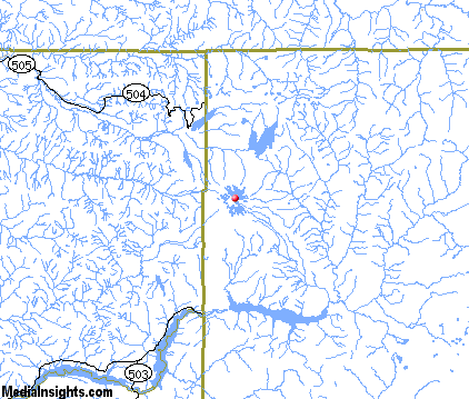
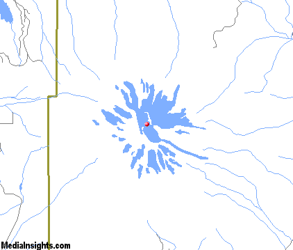
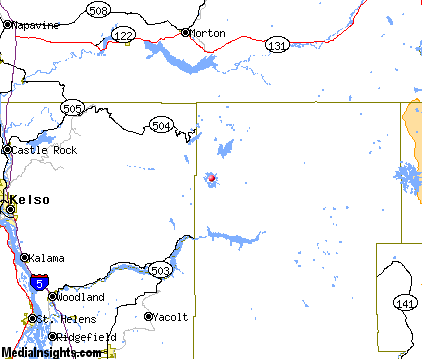
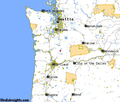
is an active volcano located in the Cascade Range in Skamania County, Washington. It is 96 miles south of Seattle and 50 miles northeast of Portland, Oregon. Mount Saint Helens is part of the Cascade Volcanic Arc, a segment of the Pacific Ring of Fire that includes over 160 active volcanoes. Mount Saint Helens is famous for its catastrophic eruption on May 18, 1980, which was the deadliest and most destructive volcanic event in the history of the U.S. Fifty-seven people were killed, and 250 homes, 47 bridges, 15 miles of railways, and 185 miles of highway were destroyed. A massive debris avalanche caused an eruption, reducing the elevation of the mountains summit from 9,677 feet to 8,365 feet and replacing it with a one-mile wide horseshoe-shaped crater. The Mount St. Helens National Volcanic Monument was created to preserve the volcano and allow for its aftermath to be scientifically studied. Mount St. Helens is 45 miles west of Mount Adams. These sister and brother volcanic mountains are approximately 50 miles from Mount Rainier, which is the highest of the Cascade volcanoes. The nearest town to Mount St. Helens is Cougar, Washington in the Lewis River Valley, about eleven miles southwest of the peak. The Gifford Pinchot National Forest surrounds Mount Saint Helens. Following the 1980 eruption, the area was left to gradually return to its natural state. In 1987, the U.S. Forest Service reopened the mountain to climbing. It remained open until 2004 when renewed activity caused the closure of the area. It was again reopened in 2006 to climbers.

|
Mount Saint Helens Vacation Rentals
|

|
|
|

|
Mount Saint Helens Hotels and Resorts
|

|
|
| | | Hotels & Motels |
| Seasons Motel | 200a Westlake Ave | Morton, WA | 25.1 mi. | (360) 496-6835 |

|
Mount Saint Helens Weather & Climate
|

|
|
|
Mount St. Helens weather can change at any time, on any day throughout the year. The weather is greatly influenced by the Pacific Ocean, elevation and latitude. Mount St. Helens is located in a remote area of southwestern Washington State. There are no cell phone towers within the Monument or the Gifford Pinchot National Forest surrounding the Monument. Even at lower altitudes, reception may or may not work, depending on weather and other factors. Do not rely on your cell phone in an emergency while visiting Mount St. Helens. Visitors are advised to have extra clothing, rain gear, and a tent for protection against storms anytime of the year.
|
| Month |
High Temp |
Low Temp |
Rainfall |
Ocean Temp |
| January |
42°F |
33°F |
17.20 in. |
- |
| February |
46°F |
34°F |
15.06 in. |
- |
| March |
52°F |
36°F |
12.14 in. |
- |
| April |
57°F |
39°F |
8.71 in. |
- |
| May |
65°F |
44°F |
5.43 in. |
- |
| June |
70°F |
49°F |
3.93 in. |
- |
| July |
78°F |
53°F |
1.54 in. |
- |
| August |
78°F |
53°F |
1.90 in. |
- |
| September |
73°F |
50°F |
4.41 in. |
- |
| October |
62°F |
44°F |
8.42 in. |
- |
| November |
48°F |
38°F |
18.33 in. |
- |
| December |
42°F |
33°F |
19.11 in. |
- |

|
Mount Saint Helens Map & Transportation
|

|
|
 |
|
|
| Click each thumbnail image to enlarge. |
 |
 |
 |
 |
The closest airports in the area are the Scappoose Industrial Airpark airport (SPB) located about 43 miles southwest of Mount Saint Helens in Scappoose, Oregon, the Portland International airport (PDX) located approximately 46 miles southwest of Mount Saint Helens in Portland, Oregon, the Portland Troutdale airport (TTD) located roughly 46 miles south of Mount Saint Helens in Portland, Oregon, the Chehalis Centralia airport (CLS) located around 50 miles northwest of Mount Saint Helens in Chehalis, Washington, the Portland Hillsboro airport (HIO) located about 58 miles southwest of Mount Saint Helens in Hillsboro ( Portland ), Oregon, the Olympia airport (OLM) located approximately 63 miles northwest of Mount Saint Helens in Olympia, Washington, the Columbia Gorge Regional The Dalles Municipal airport (DLS) located roughly 63 miles southeast of Mount Saint Helens in The Dalles, Oregon, and finally the Aurora State airport (UAO) located around 71 miles southwest of Mount Saint Helens in Aurora, Oregon.
|

|
Mount Saint Helens Attractions
|

|
|
| | | Amusement and Theme Parks |
| Oaks Amusement Park | Portland | OR | 52.2 mi. | | | Puyallup Fair | Puyallup | WA | 68.3 mi. | | | Wild Waves and Enchanted Village | Federal Way | WA | 77.8 mi. | |
| | | Water Parks |
| Wild Waves Water Park | Federal Way | WA | 77.8 mi. | |
| | | Golf Courses |
| Ironwood Green Golf Course | Glenoma | WA | 21.5 mi. | | | Maple Grove Golf | Randle | WA | 25.5 mi. | |
| | | Ski Areas |
| Cooper Spur | Portland | OR | 52.2 mi. | | | Mount Hood Meadows | Portland | OR | 52.2 mi. | | | Mount Hood Skibowl | Government Camp | OR | 65.4 mi. | |
| | | State Parks |
| Wormald State Park | | WA | 27.4 mi. | | | Ike Kinswa State Park | | WA | 29.7 mi. | | | Seaquest State Park | | WA | 30.3 mi. | | | Battle Ground State Park | | WA | 31.2 mi. | | | Paradise Point State Park | | WA | 33.9 mi. | | | Barnes State Park | | WA | 36.6 mi. | | | Lewis and Clark State Park | | WA | 37.0 mi. | | | Jackson Court House State Park | | WA | 38.2 mi. | | | Matilda Jackson State Park | | WA | 38.2 mi. | | | Beacon Rock State Park | | WA | 38.3 mi. | | | Lang Forest State Park | | OR | 39.4 mi. | |
| | | Museums |
| International Museum of Carousel Art | Hood River | OR | 46.9 mi. | (Art) | | Oregon Historical Society | Portland | OR | 52.2 mi. | (History) | | Oregon Museum of Science and Industry | Portland | OR | 52.2 mi. | (Science) | | Bathtub Art Museum | Portland | OR | 52.2 mi. | (Art) | | Portland Art Museum | Portland | OR | 52.2 mi. | (Art) |
| | | Zoos and Aquariums |
| Northwest Trek Wildlife Park | Eatonville | WA | 46.3 mi. | | | Oregon Zoo | Portland | OR | 52.2 mi. | | | Point Defiance Zoo and Aquarium | Tacoma | WA | 73.8 mi. | | | The Seattle Aquarium | Seattle | WA | 97.4 mi. | | | Woodland Park Zoological Gardens | Seattle | WA | 97.4 mi. | |
Notice a problem with the information on this page? Please notify us.
|
Disclaimer: We recommend you conduct your own research regarding all accomodations and attractions found on this website. The distances shown on this website are straight-line distances as the crow flies. The road distance may be considerably longer. You assume all liability for use of any information found on this website. No information is confirmed or warranted in any way. By using our services you agree to the terms and conditions of this disclaimer.
|
| We are the #1 site for your Washington Vacation presenting Washington vacation rentals, hotels, weather and map for each city. |
Washington Vacation .com
©1997-2025 All Rights Reserved.
|
|